Where we are now

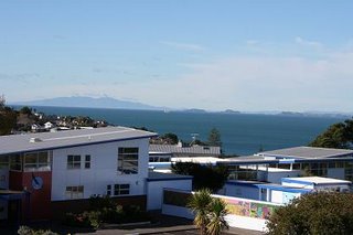
We know where we are heading, but let's take a look at where we are now. This is a photo of Murrays Bay School, up the hill from our house. This is really just the administration block, with a few classrooms to the right. There are several other classroom blocks and some sports fields out of view on the left. The photo was taken from the grounds of Murrays Bay Intermediate, which adjoins the primary school. If you look closely at the taller building you will see the school symbol, the wheeling seagull.
Beyond the school are the islands of the Hauraki Gulf, and the Rangitoto Channel. There's even a ship heading down the Channel to the Port of Auckland. The large landmass at the very back is the tip of the Coromandel Peninsula, Mt Moehau (892m!!).

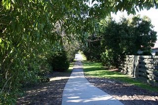
Now we head down the path (a long pathway!!) towards the beach.

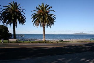
And here we are at the beach. This is Murrays Bay Beach. To the left is the wharf, popular with local fishermen (apparently you can catch squid there) and also local teenagers, who come in hoardes to jump off the end of it in summer. In fact, part of the graduation tradition from Murrays Bay School is to jump off the wharf - a rite of passage, marking the transition from primary school to intermediate, from childhood to young-personhood.
The island in the distance is Rangitoto, Auckland's iconic island. It looks the same, wherever you are in Auckland. It's a dormant volcano, formed around 600 years ago. Auckland is built on an active volcanic field - Rangitoto is the youngest of the 48 volcanos in the region. Is this a problem you ask? Well, scientists do tell us that there is a 1 in 20 chance that there will be another volcanic eruption in the Auckland region in the next 50 years. And, it's likely that any future eruption will occur in a new, unknown location, not from one of the existing volcanic cones. Who said living in New Zealand isn't exciting!!

1 Comments:
I think you (and particularly Em) might find it a bit different in France!!
Post a Comment
<< Home